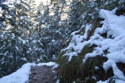
Hiking in the Bavarian Alps
This is a list of our walks and hiking in the Bavarian alps.

Itineraries
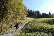
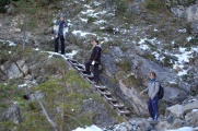
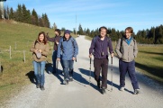
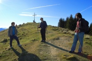
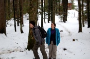
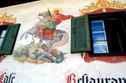
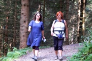
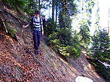
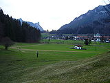
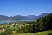
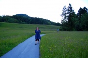
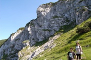
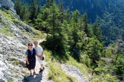
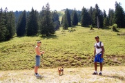
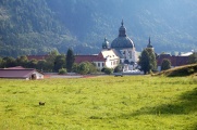
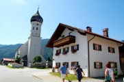
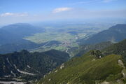
via Wamberg, Graseck and the Partnachklamm
In Yellow on the map. See the itirinary from http://www.gapa.de.
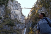
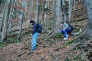
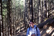
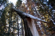
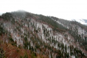
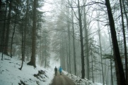
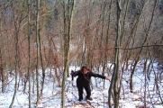
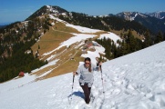
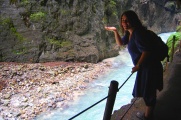
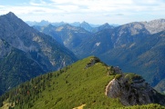
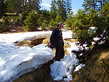
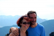
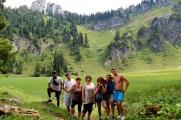
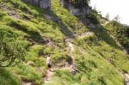
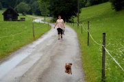
This was our first try, we loosely followed an itinerary of the gapa website. Going off-track a bit, we crossed the Eiserne Brücke, literally discovering the Partnachklamm (since we didn't know of it). This became obvious from this point onward we would return endlessly to GaPa.
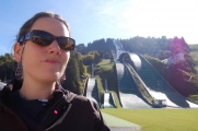
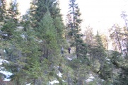
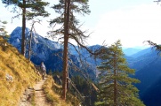
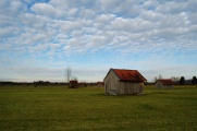
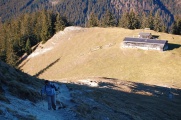
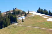
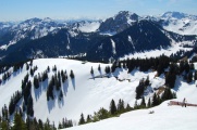
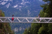
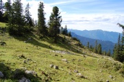
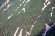
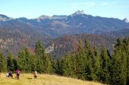
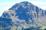
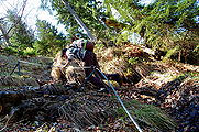
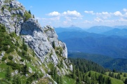
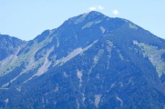
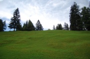
Ski jumping ramps.
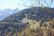
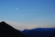
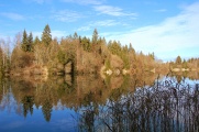
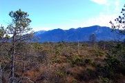
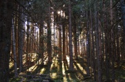
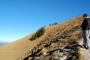
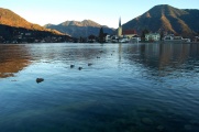
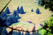
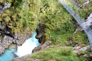
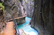
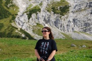
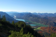
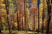
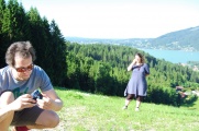
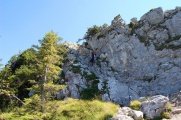
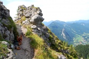
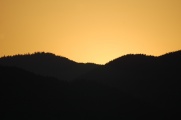
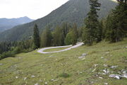
Maybe the most typical view and recurring image.
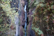
The Partnachklamm from the Eiserne Brücke.
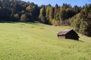
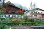
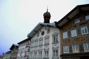
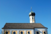
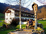
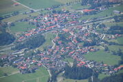
Wamberg
Id.
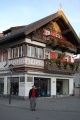
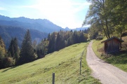
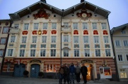
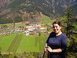
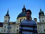
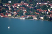
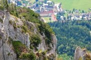
Garmisch-Partenkirchen
Id.


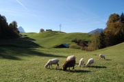
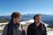
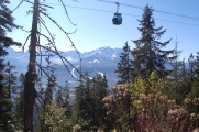
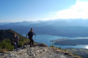
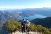
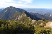
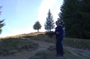
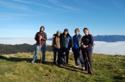
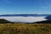
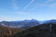
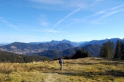
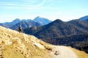
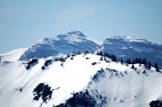
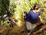
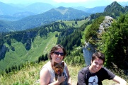
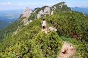
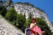
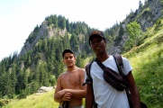
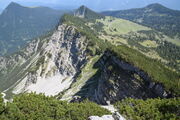
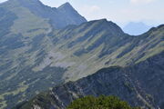
around Mount Wank
On 21 October (2011), with Alejandro Gonzalez-Tudela and Alexander Poddubny.
In Cyan on the map. See the itirinary from http://www.gapa.de.
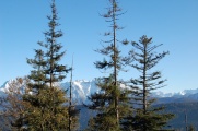
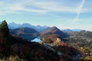
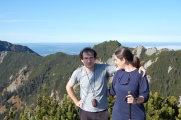
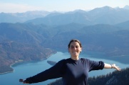
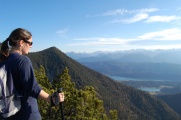
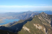
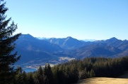
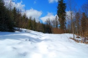
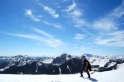
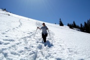
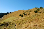
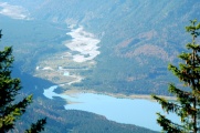
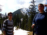
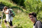
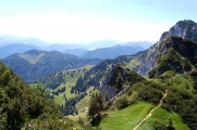
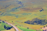
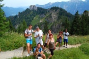
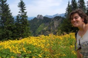
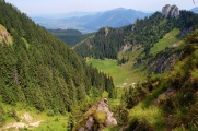
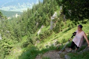
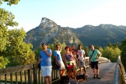
Via Esterbergalm and Gamshütte, another gapa itinerary. This one was more ambitious, 15km. Alejandro even came with two pairs of trousers. We made a lengthy stop at the Esterbergalm where we had an assortment of pressack (tr). This route offers a lot of different panorama—especially as we started at the top of the Wank with a cable-car—which is one of the particularity of the Prealps: sharp and white mountains sitting on a flat and green valley.
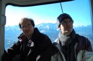
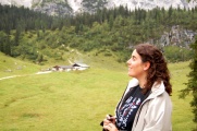
En route for the top of the Wank (no pun intended).
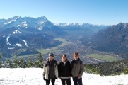
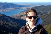
Alexander, Elena & Alejandro, with the Zugspitze in background.
Alejandro & Fabrice.
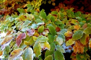
Winter kissing Autumn.
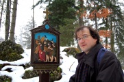
In the hands of GaPa.de.

Arriving to the Esterbergalm.


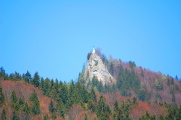
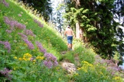
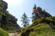
mating the Tegelberg
In Red on the map.
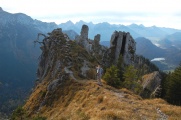
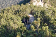
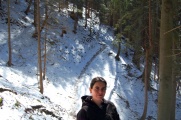
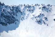
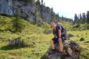
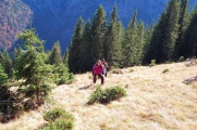
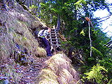
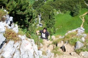
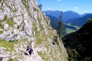
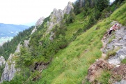
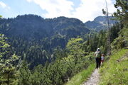
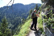
This was the first hiking designed entirely on our own, with the assistance of our GPS device. This was a marvellous walk which brought us off the crowded trails for part of the road. It was not very long (10km) but was our toughest hiking to date, with about a thousand meters ascension (and down again). We say mating the Tegelberg as—not following a pre-designed road, but going through our own itinerary with the aid of our GPS device for the first time—we were not fully convinced of the feasibility of the whole expedition. We kept in mind all the time we might have to return through whatever we had walked through so far. However we managed to go till the end and the tension of whether we would make it turned it into a genuine adventure.
At the feet of Neuschwanstein.
Marienbrücke.
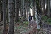
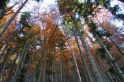
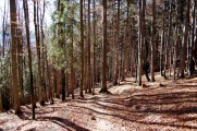
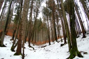
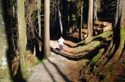
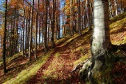
The woods of Tegelberg in Autumn.
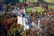
Schloss Neuschwanstein.
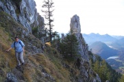
A trail high in the sky.
Near the top.
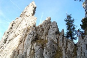
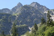
Treading on the flank of a sleeping monster.
Autumnal palette.
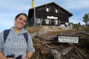
At the top, the Tegelberghaus.
Descending on the skying-side.


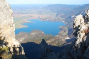
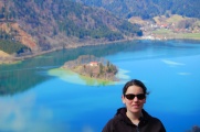
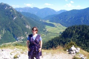
Herzogstand, Martinskopf and Heimgarten over the Walchensee
In Blue on the map.
With Alejandro Gonzalez-Tudela, through the
Herzogstand and the Heimgarten (with a loop by a local maximum, the Martinskopf).
It was our second self-made itinerary with our GPS device but this one turned out to be very touristic, with a lot of people treading on the mountain ridge. However, not being part of the regularly advertised routes in mainstream touristic destinations, it was exclusively internal tourism, which makes it less nerve-racking. A strange character at the top, half crazy, half polyglot, even asked us how we came to know about this place. He had started the conversation asking for something which, as words were materializing in his broken Spanish, became chocolate, prompting me to notice that we had saved one piece for Alejandro which he hadn't eaten... to the sudden and complete embarrassment of our friend who had understood right away that the other fellow was using this euphemism for drugs, I was thus inviting Alejandro to spare some with him.
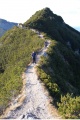
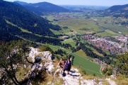
It is a very nice walk which has two features of extraordinary interest:
- You really walk on the rim of the mountain over a long distance, with two breathtaking views: on the mountainous Alps on one side and on the flat valley on the other one.
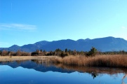
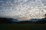
- There is a scenic view of the Blueland. It's absurdly beautiful, everything is blue, the sky, the mountains, the clouds, the lakes. Even the green looks blue.
The Blueland. Everything is blue.
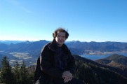
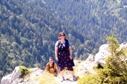
Alejandro and Elena.
Fabrice and Elena, on top of the Martinskopf. Behind us is the mountain's rim on which we are to balance ourselves.
Now on top of the Herzogstand.
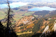
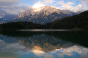
The lake is Walchensee, with its little Sassau island.
The ridge crossing to the Heimgarten.
Greeting the Kochelsee.
The ridge never gets much thinner than that. I think everybody can go.
At the top of Heimgarten.
The ridge from the other side.


Blomberg from Hinterstallau
In Pink on the map. See the gpx file for this trail.
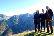
On 13, November (2011), with Alejandro Gonzalez Tudela (AGT), Alejandro Manjavacas Arevalo (AMA) and Vase & Dance Jovanov.
In the beginning of the prealps, not too violent a climb although I had programmed various "shortcuts" (a word our team came to fear) through smaller tracks crossing the woods at a much steeper angle and on sometimes not readily identified trails. Alejandro MA who is an expert hiker reassured everybody with his spotting of panels, marks on threes, spots on stones of various colours, which, as he explained, were telling us about the length. Still most of the crew preferred to follow the gentle wide road which, however, was also much longer. We managed to reprogram on the fly and could still achieve our two goals: pass by the local Biergarten and reach the top of the Blomberg. All the way down was through the woods which was a pleasant . The most notable of this walk, other than being the one with the largest number of participants, was the contrast between the foggy foot of the mountain and the sunny top.
In the Blomberg forest.
At the Blomberghaus.
En route for the top.
Almost there.
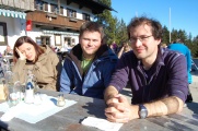
Here we are: Alejandro MA, Danse & Vase, Alejandro GT and Elena.
A thick coating of clouds over the valley. Above: sun and greenery.
AGT, Fabrice, AMA.
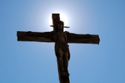
A cross crossing a cross.
Considering alternative routes.

On the way down.
Carefully down.
The wood in its last days of autumn.
Mourning in symphony.
Back in the misty fog.
A walk in Bad Tölz.
A coffee and good bye.


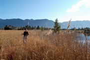
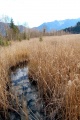
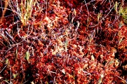
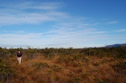
Murnauer Moors
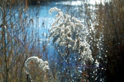
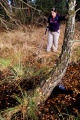
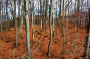
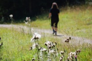
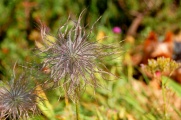
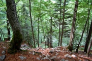
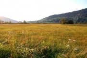
There are moors in Bavaria. We love moors, so of course we programmed them as part of our hiking in the Prealps, where they belong, unravelling their typical carpet of reddish moos as a footstep for the mountains. We had in particular a moving view of the Herzogstand, now familiar from our previous hiking. The moor area is large but most walks circle it around, and unless you venture off track, you won't see but wetlands, which are nice, but the moors are what make this area really special. It is difficult to capture their magic atmosphere in pictures, where they appear as dull brownish wild grass. You have to be there, to feel their smell, their wet perspiration, their spongy texture. Our walk was only a small fraction in this eerie décor. The rest was shared between a variety of panorama, a sample of which is featured below. Noteworthy was the contrast between woods covered by a thick layer of crimson foliage and others, also with their naked trees, but vacuum-cleaned of their dead leaves.
The swamps of Murnau,
or when water hides in the grass to hunt the sky.
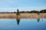
Perfect reflection on the lakes.
with Alps in the background.
Wetlands condensation...
and finally, the Moors...
with their unique carpet of moos, a tapestry of lichen.
The Murnau wetland area is noted for its rich, diverse and outstanding vegetation,
like these hairy petals of light.
Almost a Cornish atmosphere,
but with the Alps all around.
The main obstacle we had to go over.
Autumn in a wood bordering the moors.
Another wood on our way back where someone removed the leaves!
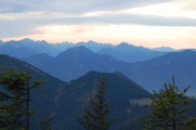
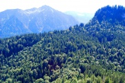
Bavarian scenery.
Clouds scattering on the mountains.
In Murnau,
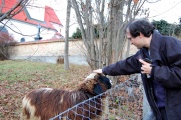
with a friend.


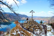
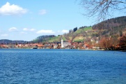
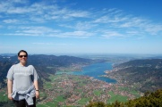
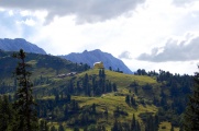
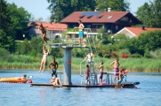
Tegernsee
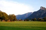
Another walk nearby a lake, the Tegernsee, a real beauty with a genuine sense of Alpine atmosphere, unlike the Starnbergsee which is usually advocated as the unique Bavarian scenery. The Starnbergsee is however too big and mountains are too far to make it something more than a swimming attraction for the Müncheners, who get an S-bahn line down to there. The smaller lakes closer to the Alps provide the real magic combination. The Tegernsee is one of them. The walk in the mountains is perfect as it alternates between wild woods with gigantic broken trees, and clear areas that provide changing views of the lake and the Alps. The Riederstein with its chapel bursting out of the woods is also a striking sight.
In the woods.
First glimpse of the lake.
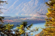
The other side of the Prealps, towards Chiemsee.
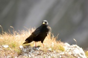
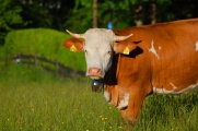
a local.
At the top.
With the Tegernsee in background.

Traces left by the never-stopping wind.
Back in the woods.
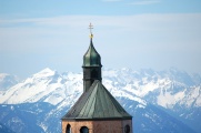
The Riederstein,
as seen from Rottach (or Rottach-Egern).
This is Rottach.


Riederstein in the fog
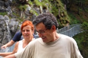
On 10 December (2011), with Tom Taylor.
Tom is a keen outdoor enthusiast, so when he came to visit us to solve some rate equations, a week-end expedition in the Alps was high in our agenda. Sadly, weather forecast was poor, so we ruled out a long hiking at the last minute and decided for a short walk in some place we already knew. We returned to the Tegernsee, our last Alpine trip, to reach the Riderstein, which we only had seen from below. We spent much time in a local Bavarian restaurant waiting for the rain to calm down, which it did right when we decided to give up. Fog kept concealing most of the mountains around the lake but past the first layer, the little church standing alone on her rocky outcrop revealed herself at once. When we finally reached it, it snowed, and it stopped just as we started to go back again.
The woods in the snow, looking so different, even when they try to retain their seasonal colours.
A very foggy day.
The Riedersteinkapelle, hiding herself from the city, was however perfectly visible from the moutain.
Is the rest of the ascension possible?
One of the 14 icons of the passion as you walk your way up.
At the top.
The Alps are drapped in clouds, the cities have disappeared,
the woods are fading away.
Back in the fog.


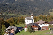
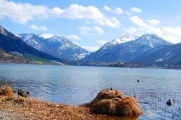
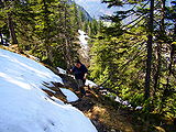
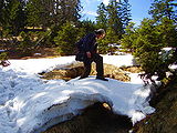
Schliersee and Hohenwaldeck
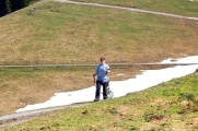
This was our first excursion of the year. Although we try very much to go to the Alps whenever possible, it is seldom possible. We planned a short itinerary and thankfully so as there was still too much snow to progress along the intended paths. We reached spots of stunning beauty, however, as they had not been visited since the last snow apart from occasional animal prints, and we could walk in glittery snow for a long time. We stumbled upon Hohenwaldeck's ruin, which we didn't know about. The ruin itself has little interest at least if you are unaware of its history (you can read it here), but the viewpoint on the lake is worth the hike. On our way back to Garching, we visited Weyarn, a stage of the Camino de Santiago. There was a statue there standing on a cenotaph for the WWs, which was particularly striking, capturing the innocent candour of these Bavarian soldiers who were sent to their death far from their yellow baroque churches with their green onion domes.
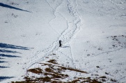
Colours of a departing winter.
Looking for a trail.
Too much snow on the path, we had to shortcut through the woods.
Immaculate scenery.
Back on the trail.
A viewing point nearby the Hohenwaldeck ruins.
Elena and the Schliersee, from above.
Back down, the Schliersee, from its banks.
The life of ducks in this part of the world.
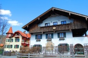
The eponymous Bavarian village,
with its picturesque painted walls,
and its maybaum.
Another village nearby, Weyarn.
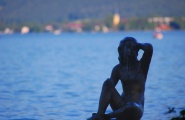
There was something a bit sad about this statue walking from one church to the other.
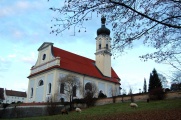
And the typical Bavarian church (that of Schliersee was prettier, though).


The Wallberg
The wallberg is literally the wall erect behind the Tegernsee. The Tegernsee is one of our favourite Bavarian lake, so we return often. But the Wallberg looks so imposing, it took us some time to even think walking it up. It is reachable by cable car but one can also get pretty close by car through a road with an obscure history (it was started under Nazi rule after a failed coup in Austria—Die Wallbergstraße mit dem Schweiß der Legionäre gepflastert. one can read somewhere) There is a nice view of a chapel sitting between the Wallberg and the Setzberg, behind. We initially planed to reach the Risserkogel too, which one accesses walking along a gorgeous ridge, but the snow foiled our attempt.
The usual start in the woods.
Quickly near the tops.
The Setzberg was covered by snow,
so we headed towards the chapel instead.
Pausing with the mountains.
A vantage point on the precipice.
Conversing with a tree.
There was loads of snow on the way to the Wallberg too,
but it was much more practicable.
The last few meters...
to the top of the Wallberg.
The other side.
The ridge towards the Risserkogel, like a razor blade.
The Tegernsee from the Wallberg.
Attempt to climb the Setzberg (The Wallberg is opposite).
This was too steep for Elena, though.
This hike also gave us our best shot of the Riederstein.


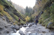
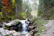
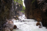
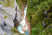
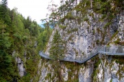
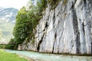
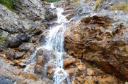
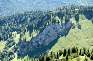
The Klamms of Partnach and Leutasch
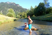
There are stunning gorges in Bavaria. We went to see the ones of Partnach and Leutasch. The former is opened all-year round and access is secured (it used to be left opened before but now there is a locked door and entry is paying; if you access it by the back, and go all the way back again, you don't have to pay). The Leutasch is opened only in summer. Most of the circuit is free (parking is 5€) except the bit that goes to the cascade, which is 2€. Overall, if you have to decide between the two, the Leutasch provides a better experience but might be more difficult of access.
The Partnachklamm
More pictures can be found in Elena's parents visit (2012).
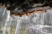
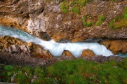
The Partnachklamm is a spot we put on our list of places to go since we stumbled upon them while crossing the river through the Eiserne Brücke. It was our first hike back in October (2011) and one that left much impressions. Looking up at this bridge from below, you get this feeling of the evil eye of a beast looking down at the little people longing the tumultuous and cold waters rushing down the gorge. In this foggy and humid atmosphere, with the water dripping abundantly making the dark walls look like they are crying, you really feel out of the green and joyful Bavaria for a while. Would the Partnachklamm be a corridor to hell when it is free of tourists?
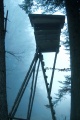
The house on top of the Ekbauer.
Elena and Inma.
Familiar sights from our first hike.
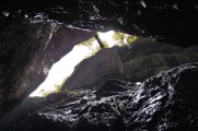
The klamm.
Elena drinking
from a curtain of water.
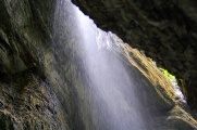
The mountain raining.
The Eiserne Brücke looking at us.


The Leutaschklamm
More pictures can be found in Elena's parents visit (2012).
Although it is allegedly smaller, the Leutaschklamm is on the other hand much more majestic and impressive. It is actually in Austria (at the very border with Germany) and you reach it from Mittenwald by heading to Leutasch, out of the country. We ended the day at Lautersee, back in Bavaria. The place is extremely quiet as cars are forbidden except for guests of the hotels. The lake was the centre of much action, however, with fishes, probably carps, hunting mosquitoes by gracefully distorting their bodies flung into the air.
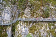
The klamm from the bridge pathway that circles the mountain.
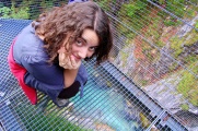
It's a grating so you see everything.
This spot had cavities where the water would whirl and spiral for a while.
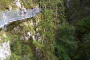
Most is along the mountains, with two bridges hopping from one flank to the other.
This one is the highest, the Panoramabrücke.
Julio has vertigo so crossing it was a bit of a challenge.
To his credit, it's how it looks from the bridge.
With Inma still on the other side.
The Karwendel, left part looks like a hedgehog.
The other part.
At the feet, there is another circuit closer to the river.
The circuit itself.
Back in the air.
This is the nearby Lautersee.


Das Schachenshaus
The Schachenshaus stands by the Schachenschloß, king Ludwig II's mountain refuge. We walked from Garmisch's olympic stadium, the closest point we found. We started a bit late in the day (after noon) because of poor traffic and an already late start from Garching. As a result, on the way back, night was getting close. We took a shortcut through the woods, which went all right till the path we followed died in the Ferchenbach river, which separated us from the main road without a bridge to cross over. It was raining and already on the dark side of the afternoon, so the decision to walk through the river was not an entirely obvious one. Completely wet till over the knees but happy, we still had to cross the Partnachklamm by then in pitch dark to complete this adventurous hike.
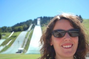
The old good ski jumping ramps from our first hike.
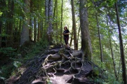
The ascent of the Kalbersteig: here a tree giving "a hand" with its roots.

The house on top of the Eckbauer from the mountain in front (with The Wank in background).
It's a long way to the Haus.
but it is like flying...
Below the clouds, the pre-Alps turning into the Alps.
Stones eating the pasture.
Fabrice resting.
The Schachenschloß in the distance. It was still horribly far.
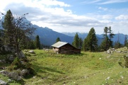
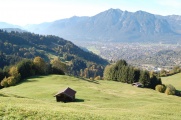
A more modest shelter.
A forefront to the real Alps.
Back on the track.
This is where Bavaria ends.
This is where the Alps begin.
There are tracks to climb this monster (if time would have allowed).

The last few meters to ascend.
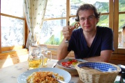
We left the mountains behind the windows of the Schachenhaus to enjoy these Bavarian specialities.
Our last picture in full daylight, at the Wettersteinalm (so still a long way to go).


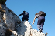
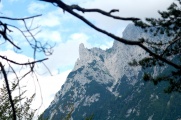
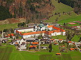
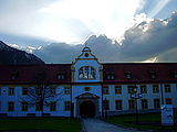
The Kreuzspitze and Ettal
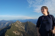
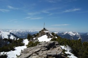
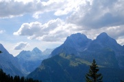
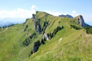
As the weather is still excellent by this time of the year, we keep going to high mountains, this time the Kreuzspitze (2185m) in preparation of our return to smaller spots of the Ammergau Alps (we'd like to try other high peaks there too, especially the Daniel). This hike is excellent as it varies between woods (splendid in autumn), small stones, middle stones, big stones and stones commensurable with the mountain itself. There is a bit of (easy) climbing involved, but the marking is excellent. It's not too advised if your vertigo is easily tickled, as you spend most of the time hung at the flank of a mountain on paths which often are no more than red splashes of paint scattered around, and when you have a thick carpet of round rocks below your feet, you really feel you could transform yourself into erosion.
On our way down, by chance, we met Kathrin and Martin on their way up (K.~is a researcher at the WSI and M. we met there for the first time). They were so fast they had time to finish the ascension and catch us again once they bounced off the top.
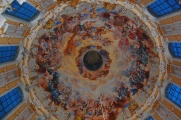
We had spotted the marvellous Ettal Abbey (Kloster Ettal) on the way and decided we'd stop there on the return. The door of the church was opened and it was an intimidating feeling to stand there in this dark, desert and baroque atmosphere, mildly fearing that the dome, overly decorated with fresco, would fall down. We had a taste of the local beers and liqueur in the restaurant in front, all from the monks.
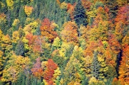
In Autumn, Bavaria's deciduous forests are particularly stunning,
as are the Alps, at any time of the year.
To reach the Kreuzspitze, you have to walk a lot on stones
narrow paths
and climb a bit.
This ridge was a local maximum.
A ridge nearby we didn't went to.
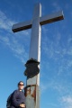
Our destination was the cross up there.
The ridge we came from, from above.
So that's the serious climbing beginning.
Better no have vertigo.
Or better don't go.
A proof that Elena was fine.
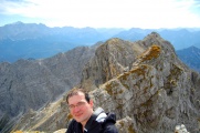
That's me at the top.
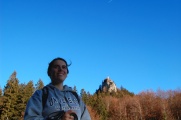
With a friend.
And Elena. The highest peak behind is the Zugspitze.
On our way back, we met Kathrin & Martin.
Those that leave their leaves and those that don't.
I made a detour there to refill our bottle.
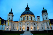
At dusk, stopping by Ettal
and its gorgeous Kloster, still open.


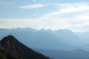
Sylvenstein
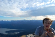
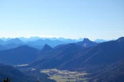
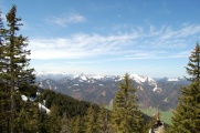
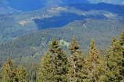
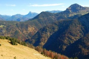
This was an easy (technically) but long hike, mainly in the woods—which is however how it should be in Autumn—and with a precious view on both the Austrian mountains on one side and on the Isar valley on the other side. The mountains in this area where the pre-Alps grow into the Alps were like a bouquet of varied specimens. Below, zooms on three interesting cases are highlighted, varying both in shapes, texture and colours.
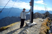
Ascending the hill nearby the Sylvenstein Stausee.
The summit for this hike, at 1540m.
Getting there.
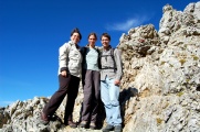
Done. With Maria and Carlos.
Overall view on the north-west side.
Overall view on the south-east side.
With the mountains, far away,
or just in front, about a kilometer in a straight line.
This one had a feeling of an African mountain.
On the other side, a view of where the Isar is born.
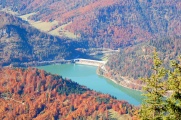
and the Sylvenstein dam, that regulates it downstream.
Getting back,
through the woods,
in Autumn.
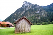
The village of Fall.


Carlos et al. over Ettal
On 24 April (2013), with Carlos Sánchez Muñoz.
First excursion of 2013, on one of the mountains overseeing the Benedictine monastery of Ettal. There was still a lot of snow past 1200m of altitude and, ironically, mainly patches covering the trail, forcing us to take tricky detours around to the despair of Elena who made a point of zealously avoiding to trod over anything white, on the account that a precipice could hide below, even in the most improbable geometry.

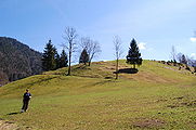
at the foot of the expedition, where everything was still green.
It got pretty tough almost from the start.
View over the monastory
and close-up.
More challenges on the way.
Trail wasn't always obvious.
Elena struggling against a gentle slope
and fighting horror at every corner.
Fabrice demonstrating there is no real danger
in a tribute to Brancaleone~[1].
The mountain in background was our initial target but we didn't go and had a sleep there instead.
Carlos overlooking Ettal.
On the left, the view over Oberammergau and the Kofelsteig.
Carlos shooting another $4\pi$ solid angle panorama.
Back in Ettal.
In the monastery.
Home to a scenic boarding school.


Bad Wiessee am Tegernsee
On 13 June (2013), with Christopher Gies.
A small hike, as there was little time, as part of the social event of our semiconductor cluster expansion colleague from Bremen, who visited us for a couple of days. Bad Wiessee (spa of the west lake) is on the western part of our favourite Bavarian lake, the Tegernsee. The village is known to historians for the Night of the Long Knives on 30 June (1934), where the SA was dissolved, with Hitler personally conducting the operation and ordering at least one execution on the spot.
Although a small loop, via the Wiesbauer and the Freihaus, with dinner on the Seepromenade, we still had time to repeat a large portion of our itinerary as we missed the first stop, getting as high as possible on the Zwergelberg without getting into the forest (and loosing the view). The Riederstein is a bit far but can be seen from a coin-operated telescope (that is in fact, free).
The Tegernsee with Maria Himmelfahrt Kirche (also with Das Kloster Tegernsee on the other side).
The bank of the Tegernsee with its eponymous village.
The biergarten from our 7th hike perched high on a patch free of forest.
Christopher. Pure style.
Preparation for the photos vom Sonnenbichl.
Alpenmilch in progress.
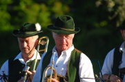
Bavarian Marschmusik in Bad Wiessee.
On the Seepromenade, teasing Rottach all year round.
Closing the loop in the nascent dusk.


Brauneck, the house mountain of Lenggries
On 23 July (2013), with Carlos Sanchez and Tizon.
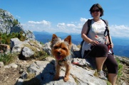
An excursion during intense working sessions with Carlos on $N$-photon lasing, but deep down in the Alps, in the Brauneck mountain range, and an intense one, of the full-day caliber (we went up with the Bahn, without which little help, we wouldn't have made it). The Alps here are gorgeous while easy to hike. They are known as the "house moutain" of Lenggries, the city in the valley of the Isar that is the first properly surrounded by mountains. We brought our Yorkshire friend Tizon who happily experienced his first hiking experience, not fearing the height nor the distance (over three times as big for him as he kept going back and forth between the head and tail of our little group).
Elena and Carlos.
Fabrice and Tizon.
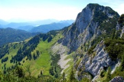
This is the most scenic view of the Brauneck.
A fur of wood and a carpet of grass draping the rocks.
The peculiar vegetation there.
The climbing geek.
Tizon ready to go.
A farm perched on a mountain.
Coming back from below,
through the forest,
with a stop here for fresh milk and cake.


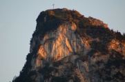
Kofel
On 2 August (2013), with Inma, Julio, Guille, Omar, Pili and Manolo (Elena's cousin, aunt and uncle).
![]() Elena's family—parents and uncles—visited us in August (2013) and we spent three days in one of the most popular destination of upper Bavaria, nearby our beloved Ettal cloister, at Oberammergau, of Passion fame. Day one was devoted to the highlight of this area: the Kofel.
Elena's family—parents and uncles—visited us in August (2013) and we spent three days in one of the most popular destination of upper Bavaria, nearby our beloved Ettal cloister, at Oberammergau, of Passion fame. Day one was devoted to the highlight of this area: the Kofel.
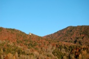
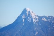
This is the Kofel in background. The top is our destination.
In between two forests, this was the first difficulty: a slipping bed of small rocks.
Not for Tizon who was at ease everywhere.
At this stage we had left behind Elena's mother and aunt, already.
Guille was second to the top.
Omar was first.
Elena fourth (after me) and Manuel fifth. At this stage we also had left Elena's father.
At the top of our Via Crucis.
The fantastic view it offers on the forest hiding the way. Somewhere in here are Elena's mother and aunt.
In the far distance, another cross, as if to say one never reaches one's destination.
The Pulvermoos, the moors between Oberammergau and Unterammergau.
Elena enjoying the fleeting moment at the summit.
On the way down, with Unterammergau (up) and Oberammergau (bottom) separated by the Pulvermoos.
Recovering her father.
Bathing with pebbles in the shallow waters of the Ammer...
as clear as they were cold even in the heart of summer.
Meanwhile, the Kofel keeps playing the Golgotha.


Laber and Soilersee
On 3 August (2013), with Inma, Julio, Guille, Omar, Pili and Manolo.
![]() On the next day, after ascending the Kofel, most people didn't feel like climbing the Laber—the nearby mountain—and went up with the Bergbahn instead. I went up with Guille, Omar and Tizon and we all met at the restaurant up there, before getting down to the Soilersee, which implied, at the general dismay, going up again (towards the Ettaler Manndl). I tried to climb the latter peak but it was too stiff and time too little, so we carried on towards Ettal, where we could catch a bus back to Oberammergau's camping.
On the next day, after ascending the Kofel, most people didn't feel like climbing the Laber—the nearby mountain—and went up with the Bergbahn instead. I went up with Guille, Omar and Tizon and we all met at the restaurant up there, before getting down to the Soilersee, which implied, at the general dismay, going up again (towards the Ettaler Manndl). I tried to climb the latter peak but it was too stiff and time too little, so we carried on towards Ettal, where we could catch a bus back to Oberammergau's camping.
Well into our ascent (about half), with Guille, Tizon and Omar.
Only us so far...
Going up to meet the rest of the family.
Guille pointing at a swimmingpool he spot in the distance.
Even Tizon got tired.
A daredevil balancing over Ettal.
The Kofel as seen from the Laber.
Now with everybody reunited.

A glimpse of the Staffelsee.
Pili and Manolo.
Elena and the Ettaler Manndl in background.
Down to the Soilersee.
Now on the other side.
The Soilersee lake was, at this time of the year, covered with vegetation.
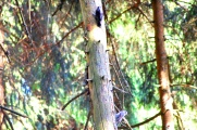
A couple of woodpeckers we surprised in the forest on our way back.
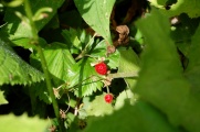
Another pleasant encounter: delicious Alpine strawberries.
A path of icy water above Ettal. Julio pointing at his foot sclerosing from completing the loop.
Ettal in sight.


Behind and around the Kofel
Behind
On 3 August (2013), with Tizon.
![]() On the third day, virtually everybody opposed the idea of climbing still another mountain. Elena finally gathered enough courage to join me (and Tizon, who didn't have a say but would have voted in favor if he could have anyway). The initial plan was that we would cross the mountain behind the Kofel and join the others at Linderhof. Due to the lack of Internet connectivity, we were not as careful with weather as we usually are when planning a hike, and the sunny afternoon turned into a menacing stormy one at some point in the evening, which prompted us to turn back given that the hike was not an especially easy one (even a dangerous one under water). For this reason, we could never see King Ludwig's famous palace, which was one of our objectives when exploring this area (but Elena's rest of the family did, and we enjoyed a rainy walk in the woods).
On the third day, virtually everybody opposed the idea of climbing still another mountain. Elena finally gathered enough courage to join me (and Tizon, who didn't have a say but would have voted in favor if he could have anyway). The initial plan was that we would cross the mountain behind the Kofel and join the others at Linderhof. Due to the lack of Internet connectivity, we were not as careful with weather as we usually are when planning a hike, and the sunny afternoon turned into a menacing stormy one at some point in the evening, which prompted us to turn back given that the hike was not an especially easy one (even a dangerous one under water). For this reason, we could never see King Ludwig's famous palace, which was one of our objectives when exploring this area (but Elena's rest of the family did, and we enjoyed a rainy walk in the woods).
Close to the starting point, the typical Bavarian huts.
Much of the walk was in the woods.
Of course, the impressive sights were near the crest.
The path along the flank.
Elena didn't find it always easy enough.
And sometime even complained outright it was over the top.
A little friend (on the elbow) providing moral support.
This is on our way back already, after we got interrupted by the rain (we had packed all electronics).
Back to our starting point, at the foot of the Kofel.
With Tizón...
...the flying...
...dog.


Around
On 4 August (2013), with everybody.
![]() It would take a whole life to even start to know the Oberammergau region, the valley circled by mountains that all seem to dwarf each others, that an inconspicuous river of icy waters visits everyday for the first time, rolling over river rocks that the sun caresses with the same frozen light as winter. Raising the eyes towards the Kofel, a feeling grasps the evening stroller of an eternity that decided to pause here as it was passing by.
It would take a whole life to even start to know the Oberammergau region, the valley circled by mountains that all seem to dwarf each others, that an inconspicuous river of icy waters visits everyday for the first time, rolling over river rocks that the sun caresses with the same frozen light as winter. Raising the eyes towards the Kofel, a feeling grasps the evening stroller of an eternity that decided to pause here as it was passing by.
An imposing bridge to cross a shallow river.
The valley of Oberammergau.
The epitome of Alpine beauty.

Oberammergau, the city.
Unterammergau, its sister.
Omar and Guille among German youth in the Stafelsee.
Night falling on the Kofel.
The same sight everywhere repeated.
Until only light and darkness remain.


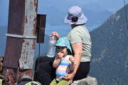
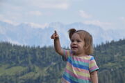
Hirschberg
On 9 July (2022), with Julia and Luz.
8 years, 11 months and 5 days after the previous walk, we resumed our Bavarian hiking series with a few hikes at and around the Hirschberg ("mountain of deers", though we only saw them sculpted in the ornaments of the house), by the Tegernsee, one of our beloved bavarian lakes.

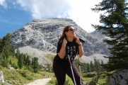
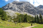
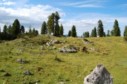
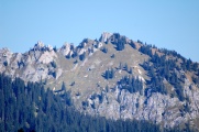
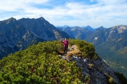
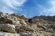
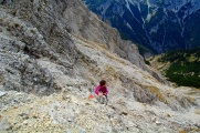
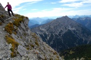
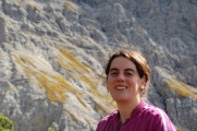
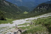
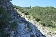
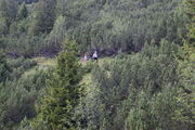
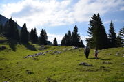
Hohe Kisten
On 16 July (2022). With Julia and Luz.
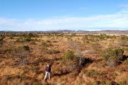
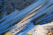
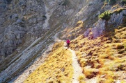
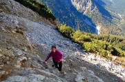
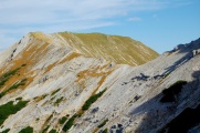
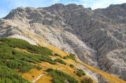
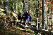
A long (25km) and big ascent (~1400m) hike on our way to the Eibsee, which got longer from the decision to take a longer route back not passing by the river of rocks which, we surmised, would be less practicable down than up, and more critically, an impromptu attempt to shortcut this longer route through flat-looking fields that happened to be another mountain—the Kessel-Kopfe—of sufficient steepness to make our way in a straight line turn into a quest for a path to bring us back to the main road. At some point, Fabrice had to walk alone to find a practicable route.

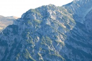
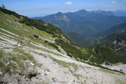
Narrow paths on the edge of the mountain after the woods.
Turning into a via ferrata.
The Bavarian Alps in their full glory.
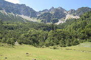
A beautiful gigantic meadow (Pustertal) to break from the more challenging trails.
The meadow actually turned out to be tiny.
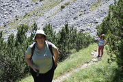
Still climbing.
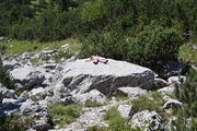
Rest (from waiting, not from walking).
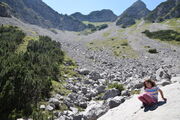
A river of stone.
Possibly the most difficult part of the route: slippery on rumbles.
Back to a more comforting trail: firmer ground and surrounding vegetation.
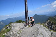
Finally at the top.
Eschenlohe looking tiny from there.
Closer view, with the Loisach river and its bridge, and the Gasthauf by its side where we had diner the previous night.
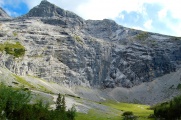
View from the top of the impressive mountain wall from below. On one side...
and the other.
Luz on her steeper summit so far.

Julia immortalizing her impressions. Note also Barbel and Slavko message on the opposite page.
Back down, the long way home.
Luz probably pointing at some mountain.
Our taking of a shortcut.
A sight we longed to see: getting back on the trail.


To do
- Tegernseerhütte
- Icekapel
- all the Bavarian lakes
Links
Garmisch-Partenkirchen
- http://www.gapa.de: around the Garmisch-Partenkirchen area.
Schwangau
Oberallgäu
| ||||||||||||||||
